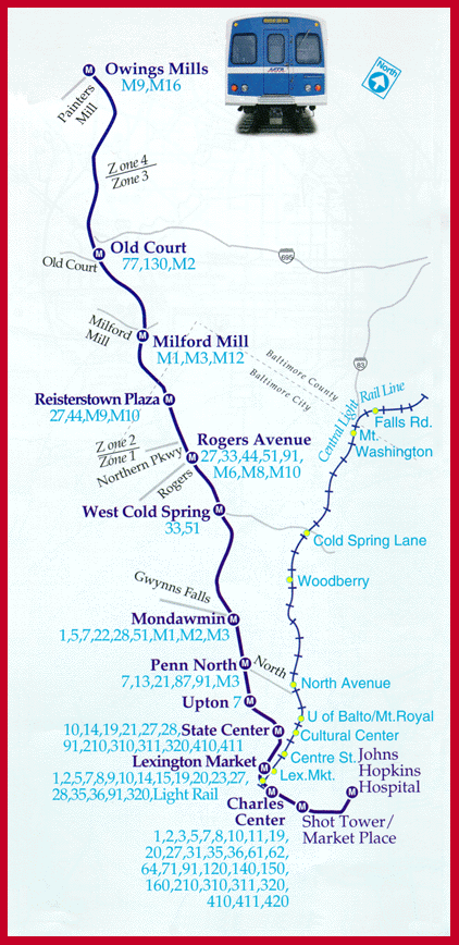
STATIONS
Owings MillsSouthbound I-795 (Northwest Expressway) & Painters Mill Road
Old Court
Old Court Road, near Greenwood Road
Milford Mill
Milford Road, one-half mile west of Reisterstown Road
Reisterstown Plaza
Wabash Ave., southeast of Patterson Ave.
Rogers Ave.
Wabash Ave., south of West Cold Spring Lane
West Cold Spring
Wabash Ave., South of West Cold Spring Lane
Mondawmin
Mondawmin Mall, southwest of Liberty Heights Ave.
Penn-Noath
Pennsylvania Ave. & W. North Ave.
Upton
Pennsylvania Ave. & Laurens St.
State Center
Preston St. & Eutaw St.
Lexington Market
On Eutaw St. at Lexington St. & Saratoga St.
Charles Center
On Baltimore St., near Charles St. & Baltimore St., near Calvert St.
Shot Tower/Market Place
On President St. at Baltimore St. & across from Shot Tower Park
Johns Hopkins Hospital
In the median of Broadway, near McElderry St. on Broadway, between Monument St. & Madison St.
- Map of Baltimore Metro (subway),
courtesy of Mass Transit Administration, Department of Transportation